Gå til forsiden
NO
Menu Meny
Lukk meny
  • Publications
  • Projects and activities
  • Weather and Climate
  • Sea and High North areas
  • Free meteorological data
  • About us
    • Gender equality at MET Norway
    • Electronic invoicing
    • Workshop on Data Evaluation for Climate Models (DECM)
    • Courses in weather observation
    • Logo
    • About the Norwegian Meteorological Institute
    • Departments
    • Vacancies
    • Partners
    • The Board
    • MET’s Privacy Policy Statement
  • Contact us
    • How to get here
  • Norwegian Meteorological Institute
  • Sea and High North areas
  • Ocean forecast

Ocean forecast

22.3.2024
Ocean forecast MET Norway.png
Map showing the areas of issued forecasts from MET Norway. Credits: MET

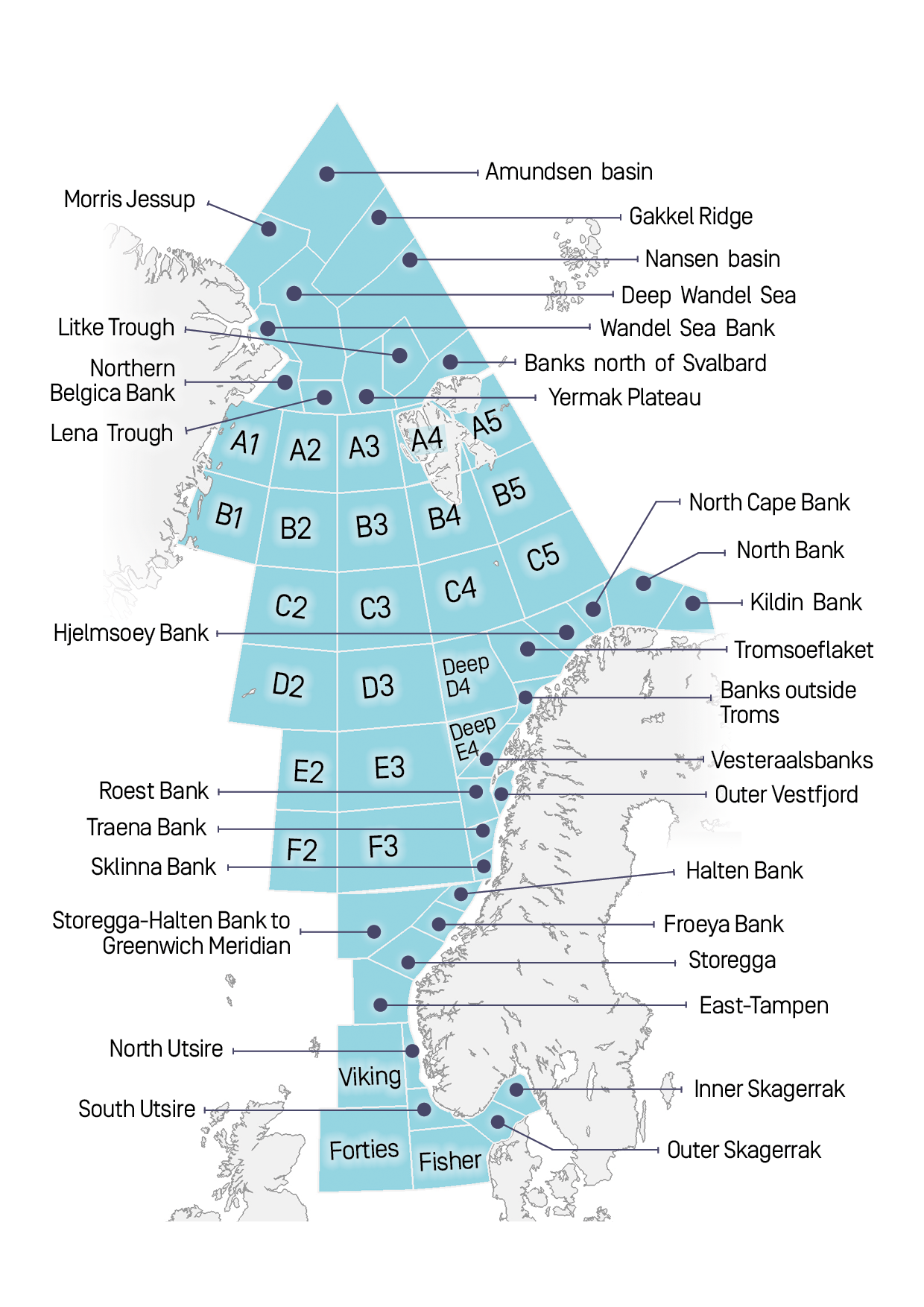
This map shows numerical codes or names of areas that we issue warnings for. We refer to these areas when issuing alerts on severe weather conditions in the coastal ares. 

Download map (pdf)

Share on twitter Share on facebook

Would you like to know more?

Our work in the sea areas
Water level along the coast and in the fjords
Forecasting severe and extreme weather

News archive

The Norwegian Meteorological Institute
Postboks 43 Blindern
0313 OSLO
Phone: +47 22 96 30 00

  • Privacy Policy
  • How to get here
  • Contact us
  • Facebook for Meteorologisk institutt
  • Twitter for Meteorologisk institutt
  • Instagram for Meteorologisk institutt